East Lordenshaw 4L (Sept 2005)
sketchfab
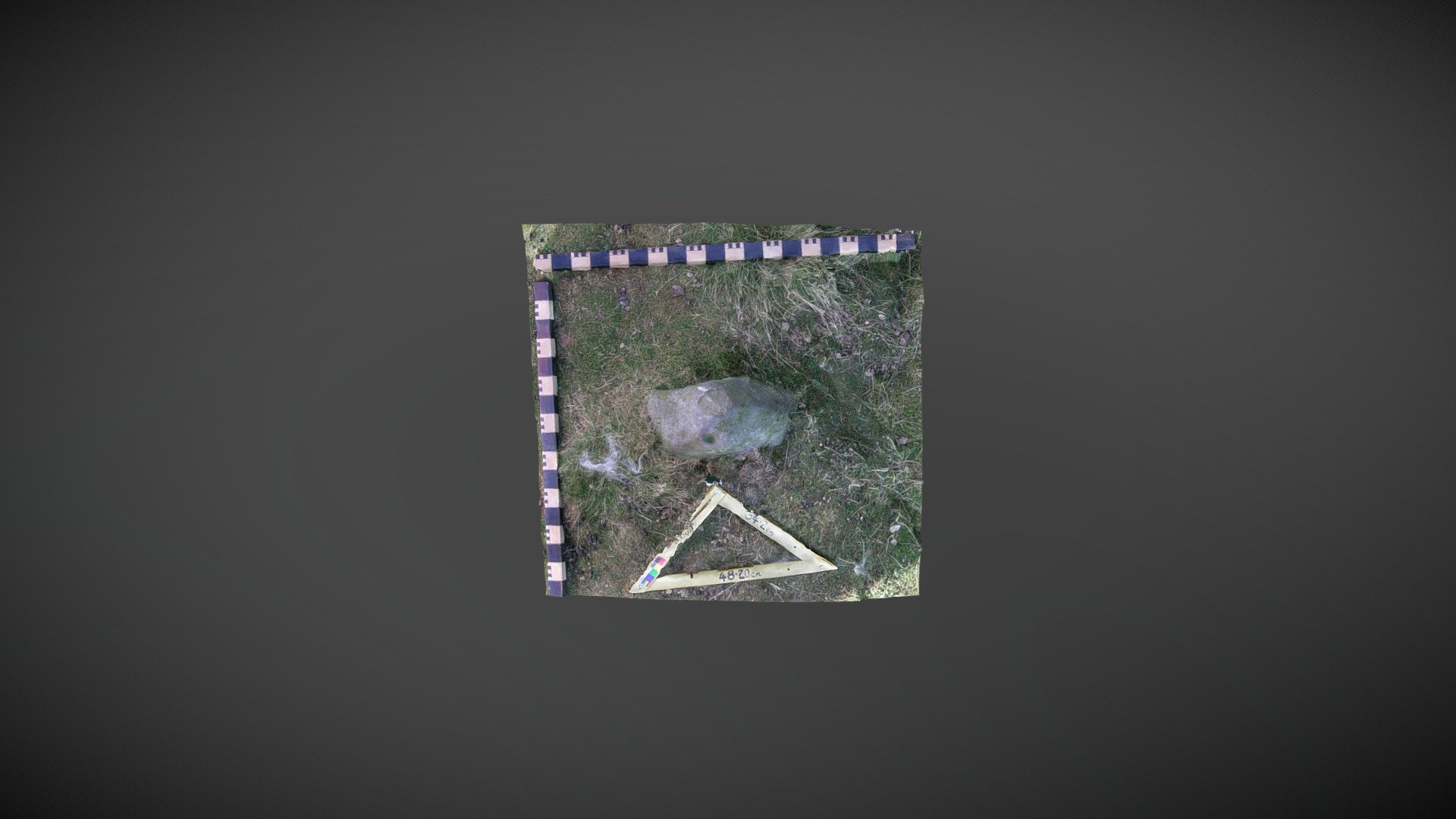
Boulder discovered within a cairn, northeast of Lordenshaw multivallate hillfort on Garleigh Moor, south of Rothbury, Northumberland. This may be reference 'East Lordenshaw 4L' in the Beckensall Archive (BA). NADRAP added the record to ERA in 2008, describing the stone as: "A small upright boulder within a trenched burial cairn structure displays two distinct depressions - one shallow and one cup-shaped. The boulder has been carefully repositioned following cairn excavation, so its original orientation or placement remain uncertain...It is unclear whether this stone was previously documented in the Beckensall Archive." Historic England area listing: https://historicengland.org.uk/listing/the-list/list-entry/1017196 ERA & BA info: https://archaeologydataservice.ac.uk/era/section/panel/overview.jsf?eraId=1278 Model created from 5 stereo pairs captured by Joe Gibson of NADRAP Team 3 in September 2005. The imagery forms part of the full NADRAP archive deposited with Historic England and Northumberland County Council.
With this file you will be able to print East Lordenshaw 4L (Sept 2005) with your 3D printer. Click on the button and save the file on your computer to work, edit or customize your design. You can also find more 3D designs for printers on East Lordenshaw 4L (Sept 2005).