East Lordenshaw 4d (July 2006)
sketchfab
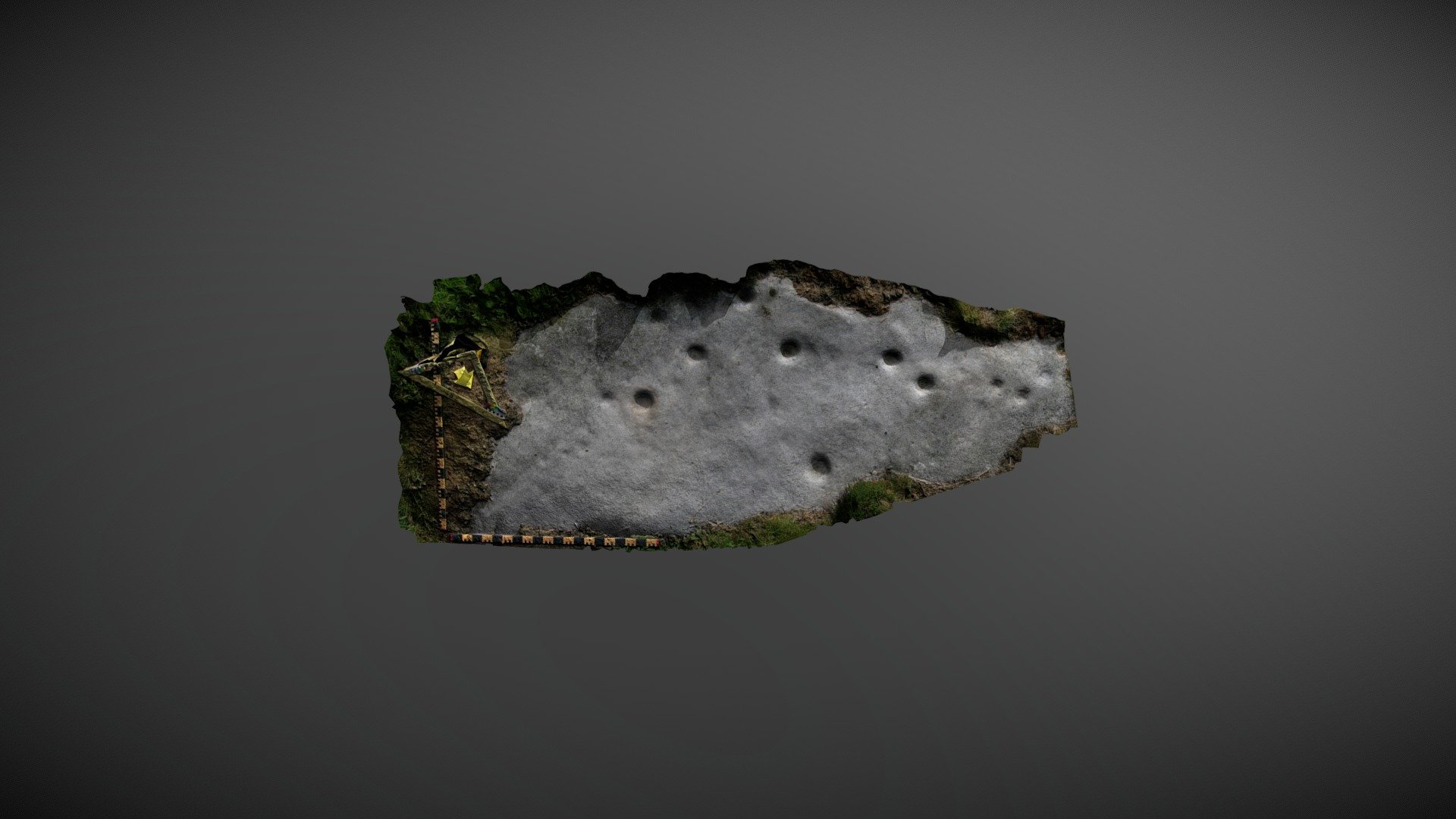
Outcrop discovered to the northeast of Lordenshaw multivallate hillfort on Garleigh Moor, south of Rothbury, Northumberland. Referenced "East Lordenshaw 4d" on the Beckensall Archive (BA), this carving was added to ERA by NADRAP in 2008 and described as: Deep and well-defined cup marks, mostly measuring between 0.08 to 0.12 meters, are scattered without apparent arrangement other than three smaller cups in a line towards the northern end, and suspected size pairing of others. One obvious groove leading from a larger cup is considered naturally formed, though possibly enhanced for definition. Some larger cups were thought to be ringed, but this could not be established with certainty. Historic England area listing: https://historicengland.org.uk/listing/the-list/list-entry/1017196 ERA & BA info: https://archaeologydataservice.ac.uk/era/section/panel/overview.jsf?eraId=1272 Model created from three stereo pairs captured by Joe Gibson of NADRAP Team 3 in July 2006. The imagery forms part of the full NADRAP archive deposited with Historic England.
With this file you will be able to print East Lordenshaw 4d (July 2006) with your 3D printer. Click on the button and save the file on your computer to work, edit or customize your design. You can also find more 3D designs for printers on East Lordenshaw 4d (July 2006).