East Lordenshaw 3h (Sept 2005)
sketchfab
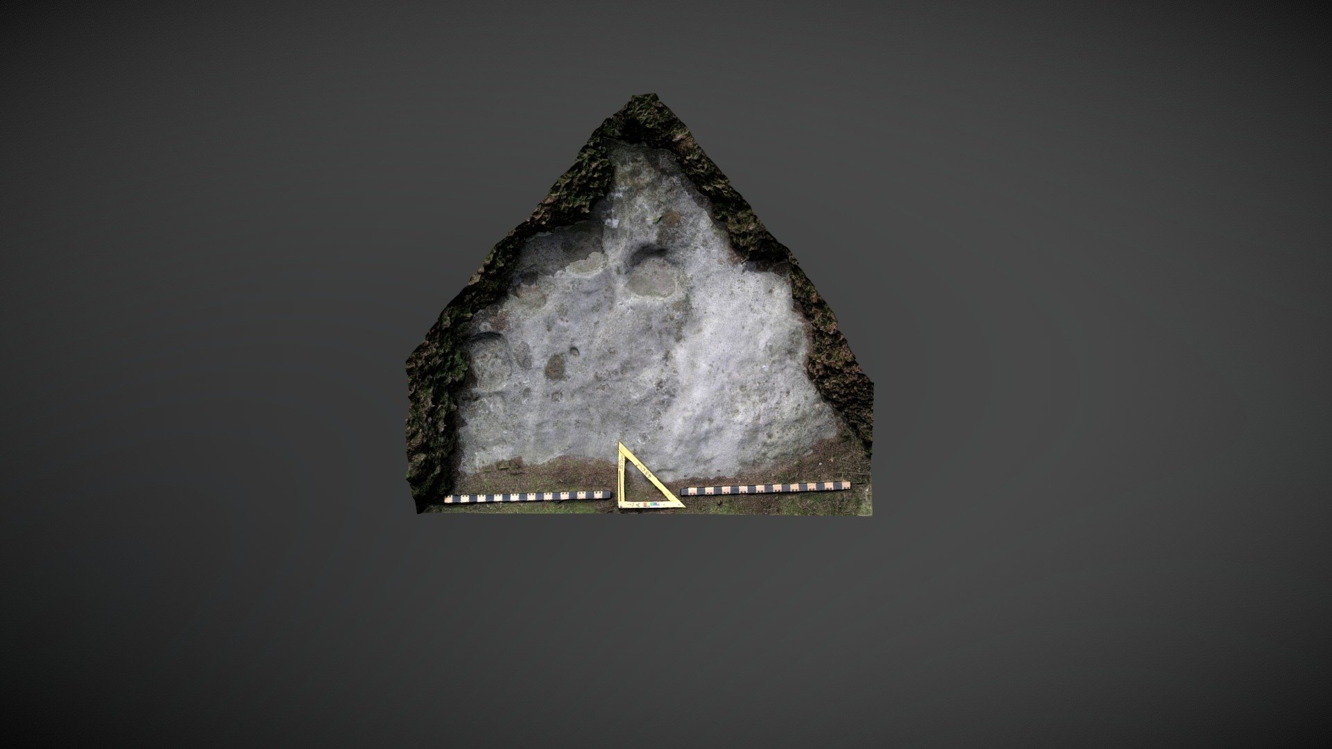
Outcrop discovered South of Lordenshaw multivallate hillfort on Garleigh Moor, South of Rothbury, Northumberland. This area of visible outcrop is referenced 'East Lordenshaw 3g' on the Beckensall Archive (BA) and features 5 natural basins and 8 small cups. NADRAP added the record to ERA in 2008, noting: "A sloping bedrock outcrop matching the hillside displays numerous bowls which may be water-formed or glacial features as seen elsewhere at East Lordenshaw. Two confirmed cups are noticeably smaller. Other motifs, referred to as being under turf in the Beckensall Archive, could not be located." Historic England area listing: https://historicengland.org.uk/listing/the-list/list-entry/1017196 ERA & BA info: https://archaeologydataservice.ac.uk/era/section/panel/overview.jsf?eraId=1324 Model created from 5 stereo pairs captured by Joe Gibson and Keith Elliott of NADRAP Team 3 in September 2005. The imagery forms part of the full NADRAP archive deposited with Historic England.
With this file you will be able to print East Lordenshaw 3h (Sept 2005) with your 3D printer. Click on the button and save the file on your computer to work, edit or customize your design. You can also find more 3D designs for printers on East Lordenshaw 3h (Sept 2005).