East Lordenshaw 3f (Sept 2005)
sketchfab
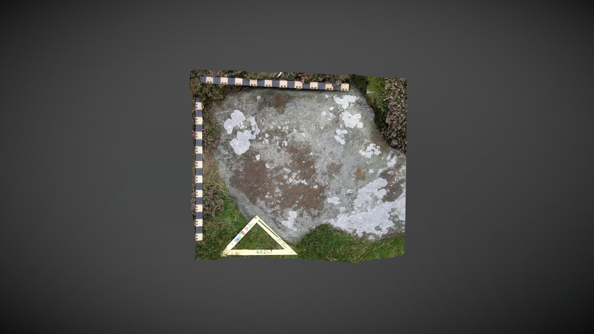
Probable outcrop discovered south of Lordenshaw multivallate hillfort on Garleigh Moor, south of Rothbury, Northumberland. This area of exposure is referenced 'East Lordenshaw 3f' on the Beckensall Archive (BA) and documented as having two cups with faint rings. NADRAP added this record to ERA in 2008 describing: "...described in the Beckensall Archive as having cups with rings. Although some indentations, which could be natural, were found at the edges, no rings or partial rings were observed during NADRAP recording..." This model depicts the cups set in shallow circular depressions, possibly explaining the rings. Historic England area listing: https://historicengland.org.uk/listing/the-list/list-entry/1017196 ERA & BA info: https://archaeologydataservice.ac.uk/era/section/panel/overview.jsf?eraId=1330 Model created from five stereo pairs captured by Joe Gibson of NADRAP Team 3 in September 2005. The imagery forms part of the full NADRAP archive deposited with Historic England and Northumberland County Council.
With this file you will be able to print East Lordenshaw 3f (Sept 2005) with your 3D printer. Click on the button and save the file on your computer to work, edit or customize your design. You can also find more 3D designs for printers on East Lordenshaw 3f (Sept 2005).