East Lordenshaw 3b (Aug 2005)
sketchfab
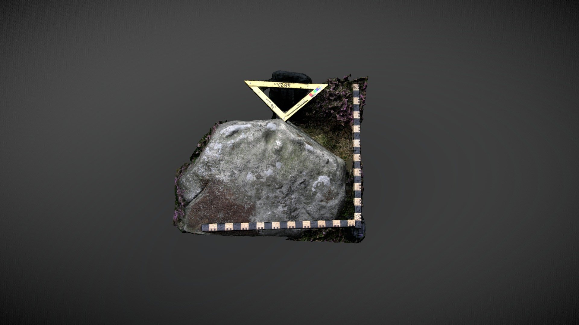
Boulder discovered to the south of Lordenshaw multivallate hillfort on Garleigh Moor, southeast of Rothbury, Northumberland. This standing boulder is cataloged as 'East Lordenshaw 3b' within the Beckensall Archive (BA) and documented with a single cup and groove. NADRAP recorded identical motifs several years later, but proposed the origin might be natural. Along with the motifs, the NADRAP added additional information about location to ERA: "The stone lies amidst a cairn field and within 20 meters of an ancient stone alignment / field wall. It is also close to the route leading to the hill fort." Historic England area listing: https://historicengland.org.uk/listing/the-list/list-entry/1017196 ERA & BA info: https://archaeologydataservice.ac.uk/era/section/panel/overview.jsf?eraId=1339 Model created from 5 stereo pairs captured by Joe Gibson of NADRAP Team 3 in August 2005. The imagery forms part of the full NADRAP archive deposited with Historic England.
With this file you will be able to print East Lordenshaw 3b (Aug 2005) with your 3D printer. Click on the button and save the file on your computer to work, edit or customize your design. You can also find more 3D designs for printers on East Lordenshaw 3b (Aug 2005).