East Branch Piscataqua River
sketchfab
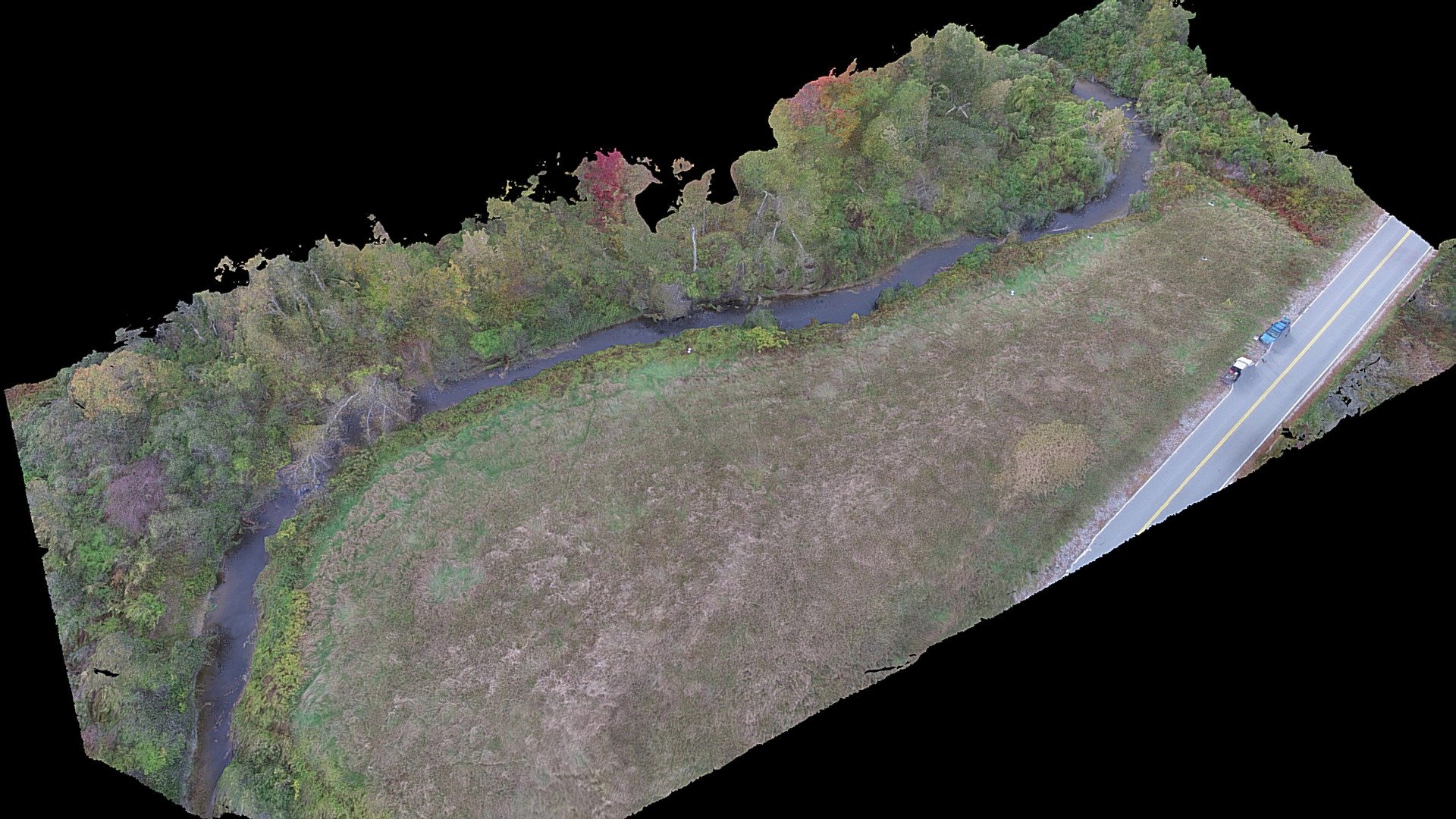
Part of the East Branch Piscataqua River in Falmouth, Maine, captures stunning imagery collected with a DJI Phantom 3 Pro soaring at 120 feet above ground level. Three hundred thirty-eight overlapping stills from nadir and slightly angled 4K video are meticulously processed in Agisoft PhotoScan Professional. The imagery was gathered on October 16, 2017. Special thanks go to Dr. Kevin Gardner for expert advice at the University of New Hampshire. Scott Greenwood and Keelin Berger receive heartfelt gratitude for their invaluable assistance with fieldwork and processing. This model is proudly made possible through resources from an NSF EPSCoR-funded project titled "RII Track-2 FEC: Strengthening the Scientific Basis for Decision-Making About Dams." The project investigates multi-scale, coupled-systems research on ecological, social, and economic trade-offs. This project receives generous support from the National Science Foundation's Research Infrastructure Improvement grant #IIA-1539071. Any opinions, findings, or conclusions expressed in this material are solely those of the author(s) and do not necessarily reflect the views of the National Science Foundation.
With this file you will be able to print East Branch Piscataqua River with your 3D printer. Click on the button and save the file on your computer to work, edit or customize your design. You can also find more 3D designs for printers on East Branch Piscataqua River.