Dobrudden South10 (July 2016)
sketchfab
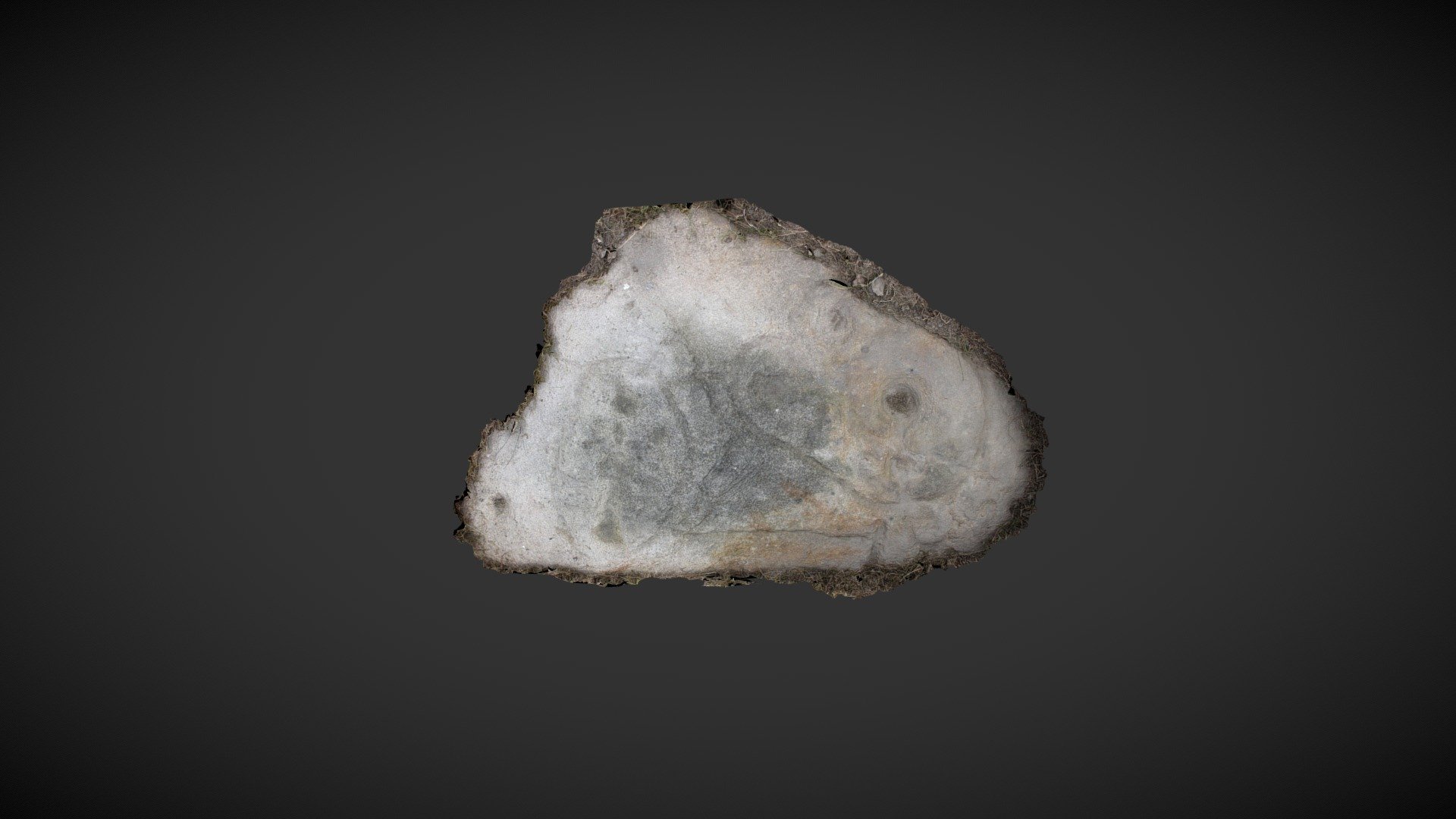
This weathered rock can be spotted partially buried in the remains of a mining shaft, located east of Dobrudden Caravan Park on Baildon Moor in West Yorkshire. It's highly unlikely to be in its original position, with the sloping angle suggesting subsidence into softer debris. First documented by Raistrick in 1934, this carving was cataloged as IAG154 in Boughey & Vickerman's 2003 publication 'Prehistoric Rock Art of the West Riding' and added to ERA by the CSI: Rombalds Moor Project as 'Dobrudden (South) 10'. The designs consist of cups, rings, and interconnected curved grooves, all of which are wide and deep. Despite being a listed protected site, the stone was partially excavated by an amateur in early 2016. On this model, the dark patina shows the area typically exposed to view. ERA / CSI Record: https://archaeologydataservice.ac.uk/era/section/panel/overview.jsf?eraId=2477 Historic England listing: https://historicengland.org.uk/listing/the-list/list-entry/1012680 This model was created from 9 images captured in July 2016.
With this file you will be able to print Dobrudden South10 (July 2016) with your 3D printer. Click on the button and save the file on your computer to work, edit or customize your design. You can also find more 3D designs for printers on Dobrudden South10 (July 2016).