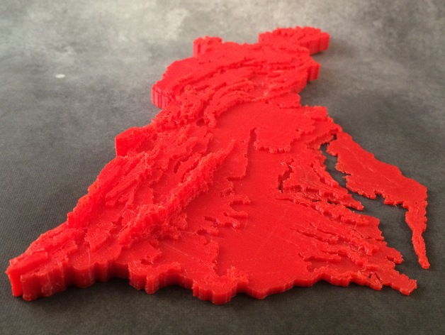
Chesapeake Bay Watershed Contour Map
myminifactory
Contour Map Illustrates Chesapeake Bay Watershed's Terrain Effect on Water Flow A summer STEM camp project, this map visualizes how terrain influences water flow into the Chesapeake Bay. For more information on its creation, visit http://designmaketeach.com/2015/07/02/design-challenge-chesapeake-bay-watershed/. I'm looking for a simpler method to produce similar maps as educational tools. If you can assist, please comment below or reach out via Twitter @DesignMakeTeach.com. This map was designed with Tinkercad and can be edited online at https://www.tinkercad.com/things/aq5nCOnZCEA. I've also created a laser-cut and paper version using the same base SVG files, though they haven't been published yet. An error exists in the file due to my experimentation with simplifying contour lines.
With this file you will be able to print Chesapeake Bay Watershed Contour Map with your 3D printer. Click on the button and save the file on your computer to work, edit or customize your design. You can also find more 3D designs for printers on Chesapeake Bay Watershed Contour Map.
