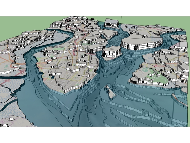
Charleston SC 3D Peninsula and Harbor (LaserCut)
thingiverse
This project has been something I've wanted to tackle for a while now, creating a 3D hypsographic/topographic representation of Charleston's South Carolina peninsula and harbor. The ultimate goal is to laser cut this and display it in a shadowbox frame on the wall of my home here in Charleston. The files provided are intended to be first laser engraved then carefully cut with the laser cutter. The SVG file provided may not be formatted for cutting or engraving, so please use the files included in the ZIP archive instead. How I Designed This This is a direct result of a massive amount of work on my part: I downloaded and processed raw elevation and bathymetry data using ArcGIS, generating and refining contours to accurately represent the intervals that will be cut out of 1/8" birch plywood. I was able to export from ArcGIS into XPS format, which can then be read by Full Spectrum's RetinaEngrave software. The images were produced in SketchUp, utilizing exported TIFs and DXF data from ArcGIS, stacked together to represent the finished physical model as it will appear when complete.
With this file you will be able to print Charleston SC 3D Peninsula and Harbor (LaserCut) with your 3D printer. Click on the button and save the file on your computer to work, edit or customize your design. You can also find more 3D designs for printers on Charleston SC 3D Peninsula and Harbor (LaserCut).
