Calgary Road Network and Streets 3D model
cgtrader
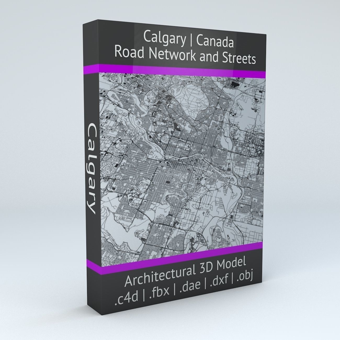
This model exhibits realism due to its data-driven road network and street layout in Calgary, Canada. It includes two primary components: roads/streets and squares/plazas. UV mapping is applied with overlapping UVs for seamless texturing. The 3D model sits flat on a surface (road network at the "floor" level), without elevation data. Geometry consists of polygonal quads and tris, while remaining untextured to render swiftly. Commercial use is permitted under the Creative Commons Attribution-ShareAlike 2.0 (CC-BY-SA) license. OpenStreetMap provides building and street data (www.openstreetmap.org), with attribution to © OpenStreetMap contributors. The model contains 1,784,666 points/verts and 1,832,602 polygons. Native format is .c4d, while additional formats include v7.1 FBX, v1.5 DAE, DXF, OBJ.
With this file you will be able to print Calgary Road Network and Streets 3D model with your 3D printer. Click on the button and save the file on your computer to work, edit or customize your design. You can also find more 3D designs for printers on Calgary Road Network and Streets 3D model.