Bremore Head
sketchfab
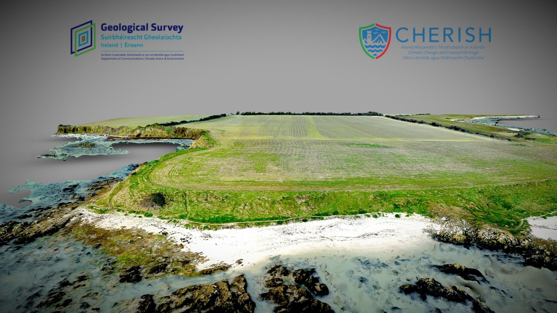
Bremore Head is situated just 2.5 kilometers north of Balbriggan town. The Geological Survey Ireland is conducting thorough UAV and STS surveys across a 0.3 kilometer square site as part of the Cherish Project, which can be found at http://www.cherishproject.eu/en/. These surveys are focused on studying the effects of climate change on Newhaven's 16th Century harbor and nearby cliff face that is rapidly eroding. The area's volcanic bedrock was formed approximately 460 million years ago during the Iapetus Ocean's closure. Above this lies a layer of sub-glacial till, also known as boulder clay, which was deposited under an ice sheet about 20 thousand years ago. The harbor in the study area's southeast is defined by a 62-meter dry stone pier that extends from the shoreline in a northeast direction and runs roughly parallel to the headland. This survey was successfully completed over three flights using the microdrones md4-3000 at mid tide on February 19, 2019.
With this file you will be able to print Bremore Head with your 3D printer. Click on the button and save the file on your computer to work, edit or customize your design. You can also find more 3D designs for printers on Bremore Head.