Boundary Stone
sketchfab
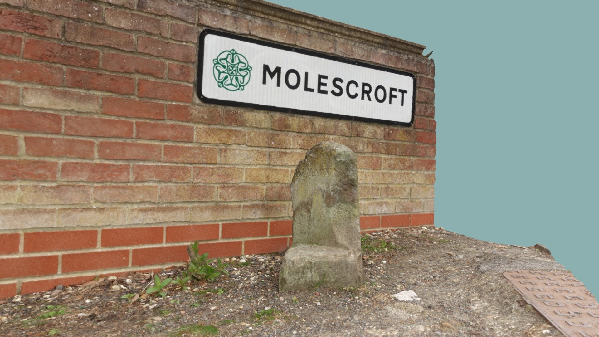
Boundary markers play a vital role in defining the parish boundaries in Beverley, East Yorkshire. A thorough mapping exercise was conducted between 1851-2, revealing that the existing boundaries may have been largely similar to those established during the Middle Ages. Specifically, St Mary's township comprised the northern part of the town and extended northwards into the township of Molescroft. The boundary's crossing point with Woodhall Way (previously known as Pighill Lane) remains marked by a stone inscribed 'ST MARY'S', while a modern sign on the boundary wall indicates the start of Molescroft. Today, the shared boundary is clearly defined by a public right-of-way stretching from Woodhall Way to the intersection of Molescroft Road and Bleach Yard.
With this file you will be able to print Boundary Stone with your 3D printer. Click on the button and save the file on your computer to work, edit or customize your design. You can also find more 3D designs for printers on Boundary Stone.