Barningham Moor 95 (March 2008)
sketchfab
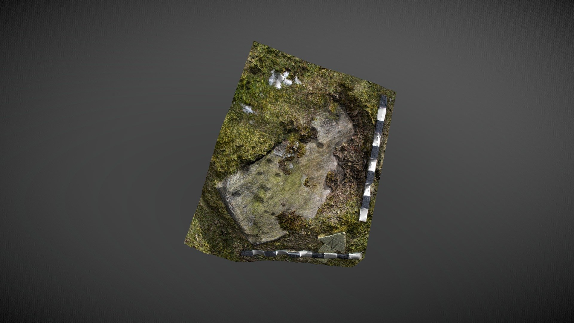
Cup marked rock placed prominently to the west of How Tallon ridge on Barningham Moor, County Durham. This small rectangular rock occupies a strategic location within a dense cluster of other carvings near the Romano-British settlement. Although it was clearly marked on the 1998 map in Beckensall & Laurie's publication 'Prehistoric Rock Art of County Durham, Swaledale and Wensleydale,' it did not receive a reference number at that time. NADRAP correctly identified this stone as 'Barningham Moor 94' on ERA in 2008, noting: "This is a small rectangular stone featuring six small shallow cups clustered towards the southern end." The ERA record can be accessed online at https://archaeologydataservice.ac.uk/era/section/panel/overview.jsf?eraId=897. Additionally, this site has been designated as an area of historic interest by Historic England, with listing number 1017441, available on their website at https://historicengland.org.uk/listing/the-list/list-entry/1017441. A 3D model was created from four images taken by the NADRAP Team in March 2006, which are part of the ERA/NADRAP archive.
With this file you will be able to print Barningham Moor 95 (March 2008) with your 3D printer. Click on the button and save the file on your computer to work, edit or customize your design. You can also find more 3D designs for printers on Barningham Moor 95 (March 2008).