Barningham Moor 93 (May 2006)
sketchfab
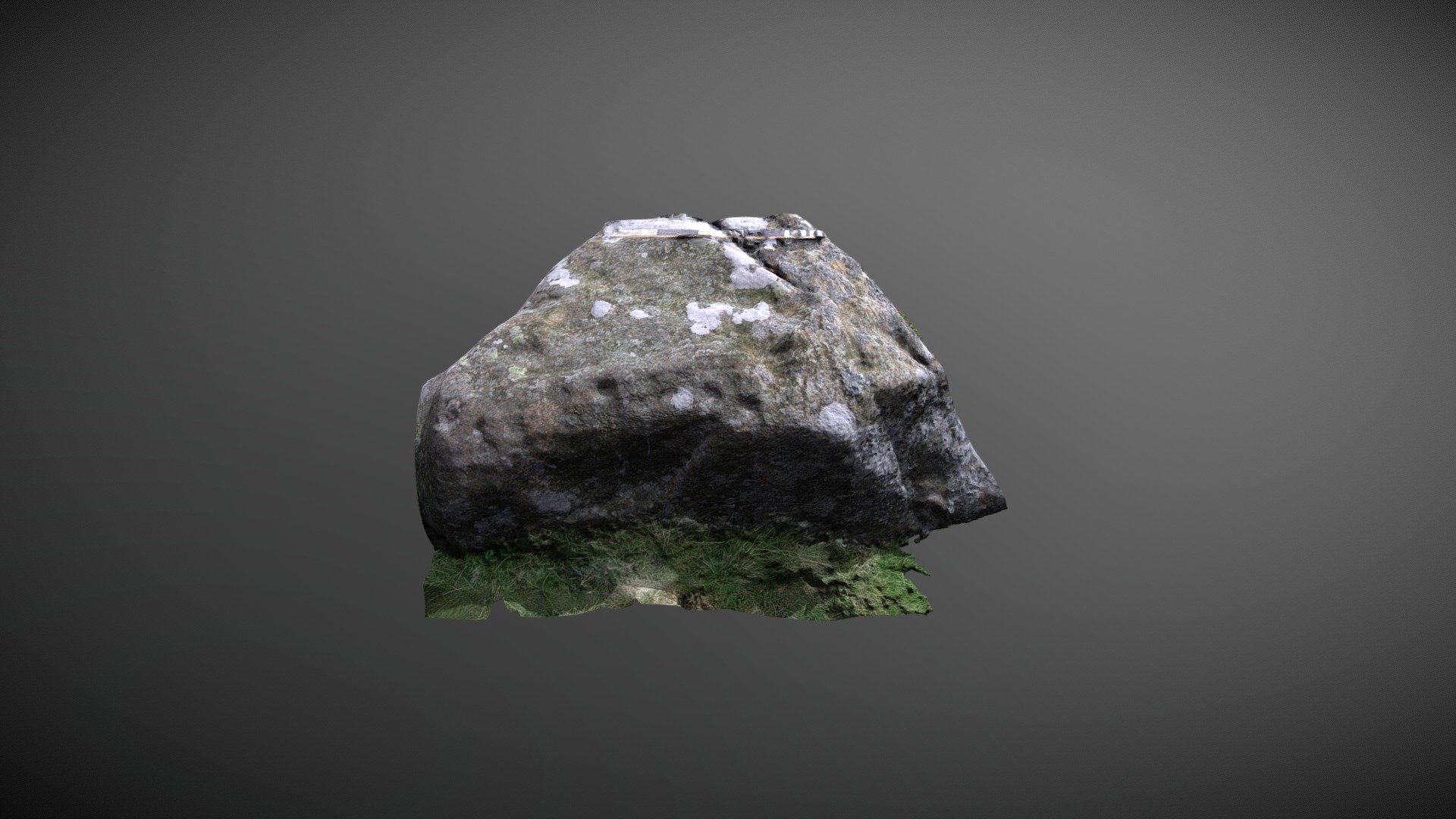
Possible cup-marked rock positioned to the west of How Tallon Ridge, on Barningham Moor, County Durham. This stone sits in a dense cluster of carvings west of the settlement and immediately next to a hallowed way. It's unclear whether this was previously referenced or a new find during NADRAP surveys. Added to ERA as 'Barningham Moor 93' in 2008, the team recorded: "... On the upper surface and towards the edges eleven heavily eroded cup-like depressions of varying size can be found. A certain degree of pitting has taken place on the stone, so these depressions are likely to be just natural weathering." ERA record: https://archaeologydataservice.ac.uk/era/section/panel/overview.jsf?eraId=895 Historic England area scheduling: https://historicengland.org.uk/listing/the-list/list-entry/1017441 This model is created from 5 images captured by NADRAP Team 5 in May/October 2006. The imagery forms part of the full NADRAP archive deposited with Historic England.
With this file you will be able to print Barningham Moor 93 (May 2006) with your 3D printer. Click on the button and save the file on your computer to work, edit or customize your design. You can also find more 3D designs for printers on Barningham Moor 93 (May 2006).