Barningham Moor 91 (May 2006)
sketchfab
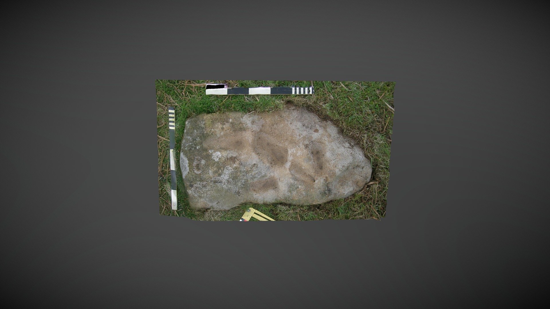
The stone lies exposed on the scarp below How Tallon ridge, positioned just south of the settlement on Barningham Moor, County Durham. This carved stone was uncovered during NADRAP surveys conducted in 2006 while probing the steep slope south of the settlement. It is cataloged as 'Barningham Moor 91' within ERA and described as follows: "This relatively small stone bears six elongated deep depressions covering roughly 40% of its surface. Three of these depressions show signs of being nipped in the middle, indicating they may be conjoined cups. Although these features do not resemble typical cup-like markings, the presence of tooling marks (which could also be pitting) and their placement suggest an element of enhancement." The ERA record can be accessed at https://archaeologydataservice.ac.uk/era/section/panel/overview.jsf?eraId=893. It has been included in Historic England's area scheduling, which is available at https://historicengland.org.uk/listing/the-list/list-entry/1017441. A 3D model was created using six stereo pairs captured by NADRAP Team 5 in May 2006 as part of the full NADRAP archive.
With this file you will be able to print Barningham Moor 91 (May 2006) with your 3D printer. Click on the button and save the file on your computer to work, edit or customize your design. You can also find more 3D designs for printers on Barningham Moor 91 (May 2006).