Barningham Moor 88 (June 2006)
sketchfab
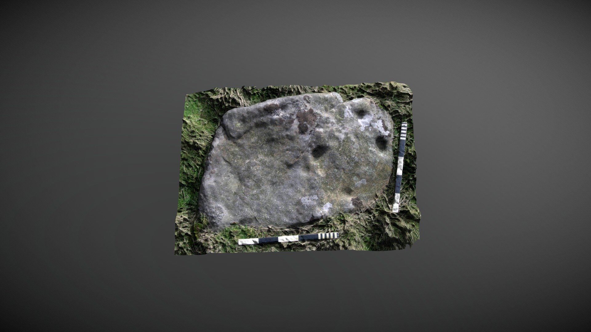
Positioned to the east of Osmaril/Osmonds Gill and to the west of How Tallon ridge on Barningham Moor, County Durham. This sub-rectangular sandstone block holds a prime position overlooking the serene Osmonds Gill. Referenced as 65 in the 1998 publication "Prehistoric Rock Art of County Durham, Swaledale and Wensleydale," NADRAP added this carving to ERA as 'Barningham Moor 88' in 2008. The team reported: This stone boasts eight cup-like depressions located on its top surface. Two cups situated on the south-west corner are deep and well-formed, and are likely artificial, two cups positioned centrally are egg-shaped and probably naturally formed. The other four cups could be either natural or man-made. ERA record: https://archaeologydataservice.ac.uk/era/section/panel/overview.jsf?eraId=890 Historic England area scheduling: https://historicengland.org.uk/listing/the-list/list-entry/1017441 Model created from six stereo pairs captured by NADRAP Team 5 in June/October 2006. The imagery forms part of the full NADRAP archive.
With this file you will be able to print Barningham Moor 88 (June 2006) with your 3D printer. Click on the button and save the file on your computer to work, edit or customize your design. You can also find more 3D designs for printers on Barningham Moor 88 (June 2006).