Barningham Moor 71 (Oct 2006)
sketchfab
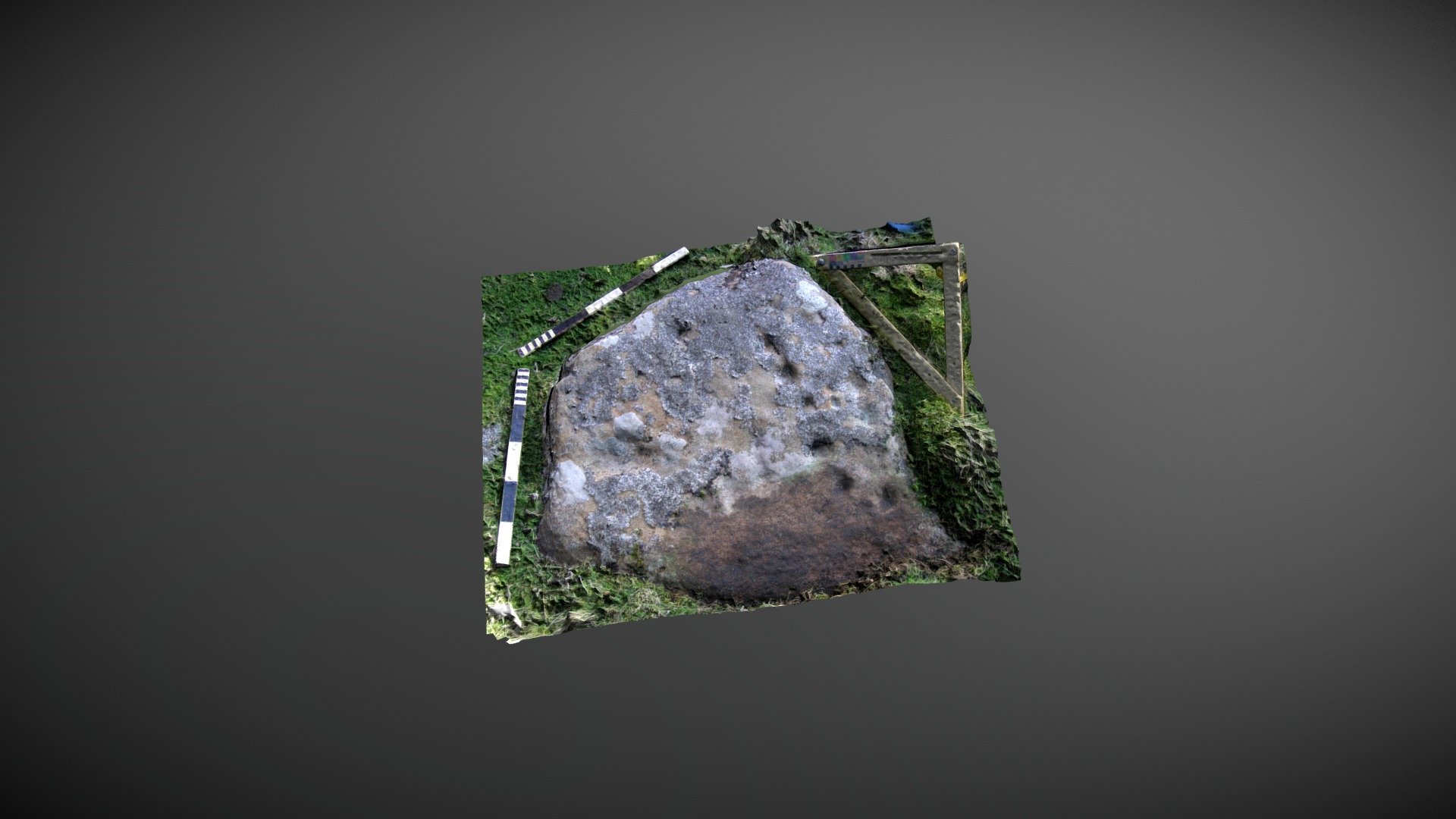
Fairly flat stone, situated below How Tallon ridge on Barningham Moor in County Durham. This heavily lichen-encrusted stone is located to the west of a probable Romano-British settlement and forms part of a dense cluster of carvings in this area of the moor. It's referenced as number 55 in Beckensall & Laurie's 1998 publication "Prehistoric Rock Art of County Durham, Swaledale and Wensleydale" and was added to ERA by NADRAP as "Barningham Moor 71" in 2008. The team recorded that seventeen cups of varying size can be seen clustered on the western edge of the stone. A single wide groove or possibly two conjoined cups is visible on the north-east corner. ERA record: https://archaeologydataservice.ac.uk/era/section/panel/overview.jsf?eraId=873 Historic England area scheduling: https://historicengland.org.uk/listing/the-list/list-entry/1017441 A model created from two stereo pairs captured by NADRAP Team 5 in October 2006 forms the basis of this imagery, which is part of the ERA / NADRAP archive.
With this file you will be able to print Barningham Moor 71 (Oct 2006) with your 3D printer. Click on the button and save the file on your computer to work, edit or customize your design. You can also find more 3D designs for printers on Barningham Moor 71 (Oct 2006).