Barningham Moor 67 (Oct 2006)
sketchfab
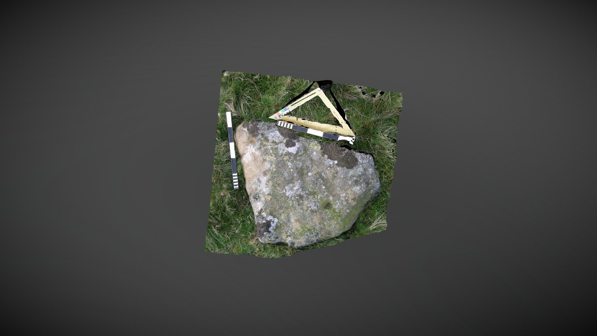
Found on lower slopes, just north of the main settlement site below How Tallon ridge on Barningham Moor, County Durham. This stone sits atop a small knoll and is documented 'EB' in Beckensall & Laurie's 1998 publication 'Prehistoric Rock Art of County Durham, Swaledale and Wensleydale.' NADRAP referenced the stone as 'Barningham Moor 67,' adding the record to ERA in 2008 with this description: "All three depressions on this stone are irregular and do not conform to typical cup mark patterns. Weathering has caused an undulating surface, and pitting can be seen in certain areas. It's uncertain whether these cups are man-made or naturally formed." ERA record: https://archaeologydataservice.ac.uk/era/section/panel/overview.jsf?eraId=869 Historic England area scheduling: https://historicengland.org.uk/listing/the-list/list-entry/1017441 Model created from 2 stereo pairs captured by NADRAP Team 5 in October 2006. The imagery forms part of the ERA/NADRAP archive.
With this file you will be able to print Barningham Moor 67 (Oct 2006) with your 3D printer. Click on the button and save the file on your computer to work, edit or customize your design. You can also find more 3D designs for printers on Barningham Moor 67 (Oct 2006).