Barningham Moor 66 (Oct 2006)
sketchfab
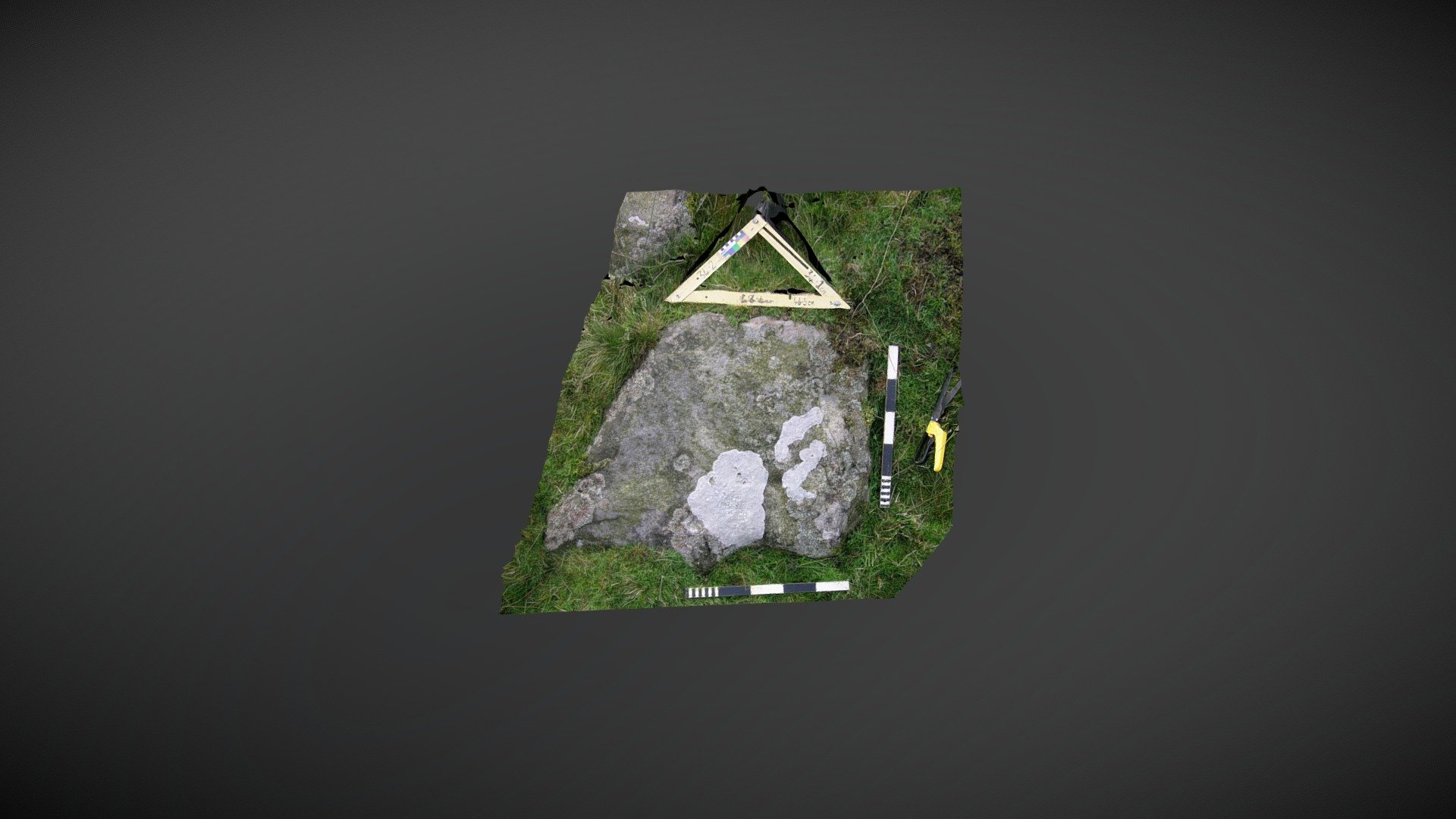
Found on lower slopes, just north of the main settlement site below How Tallon ridge on Barningham Moor, County Durham. This stone forms part of a wall that runs down from the probable Romano-British settlement site to the south. It sits several meters west of a burnt mound, which may indicate that settlement in the area stretches further back than the Romano-British period. First mentioned in Beckensall & Laurie's 1998 publication "Prehistoric Rock Art of County Durham, Swaledale and Wensleydale", NADRAP recorded it on ERA as "Barningham Moor 66". It has only two cups. ERA record: https://archaeologydataservice.ac.uk/era/section/panel/overview.jsf?eraId=868 Historic England area scheduling: https://historicengland.org.uk/listing/the-list/list-entry/1017441 Model created from 2 stereo pairs captured by NADRAP Team 5 in October 2006. The imagery forms part of the ERA/NADRAP archive
With this file you will be able to print Barningham Moor 66 (Oct 2006) with your 3D printer. Click on the button and save the file on your computer to work, edit or customize your design. You can also find more 3D designs for printers on Barningham Moor 66 (Oct 2006).