Barningham Moor 65 (Oct 2006)
sketchfab
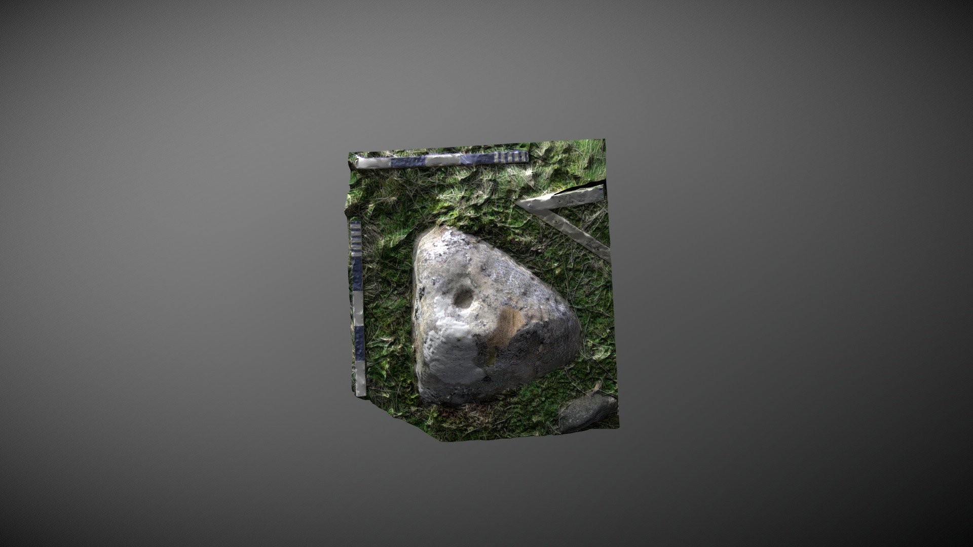
Found within the settlement site below How Tallon ridge on Barningham Moor, County Durham. This small triangular stone sits outside a probable Romano-British settlement about 43m west of a likely hut circle. Referenced 47 in Beckensall & Laurie's 1998 publication 'Prehistoric Rock Art of County Durham, Swaledale and Wensleydale', it was added to ERA by NADRAP in 2008 as 'Barningham Moor 65. The team discovered two cups, with the most southerly having a diameter of 0.05m and a depth of 0.03m, and the cup on the north-facing side measuring 0.04m in diameter and 0.01m in depth. Is there a partial ring around the top cup? ERA record: https://archaeologydataservice.ac.uk/era/section/panel/overview.jsf?eraId=867 Historic England area scheduling: https://historicengland.org.uk/listing/the-list/list-entry/1017441 Model created from 2 stereo pairs captured by NADRAP Team 5 in September 2006. The imagery forms part of the ERA / NADRAP archive. The stone was found damaged during recording in 2006.
With this file you will be able to print Barningham Moor 65 (Oct 2006) with your 3D printer. Click on the button and save the file on your computer to work, edit or customize your design. You can also find more 3D designs for printers on Barningham Moor 65 (Oct 2006).