Barningham Moor 55 (June 2006)
sketchfab
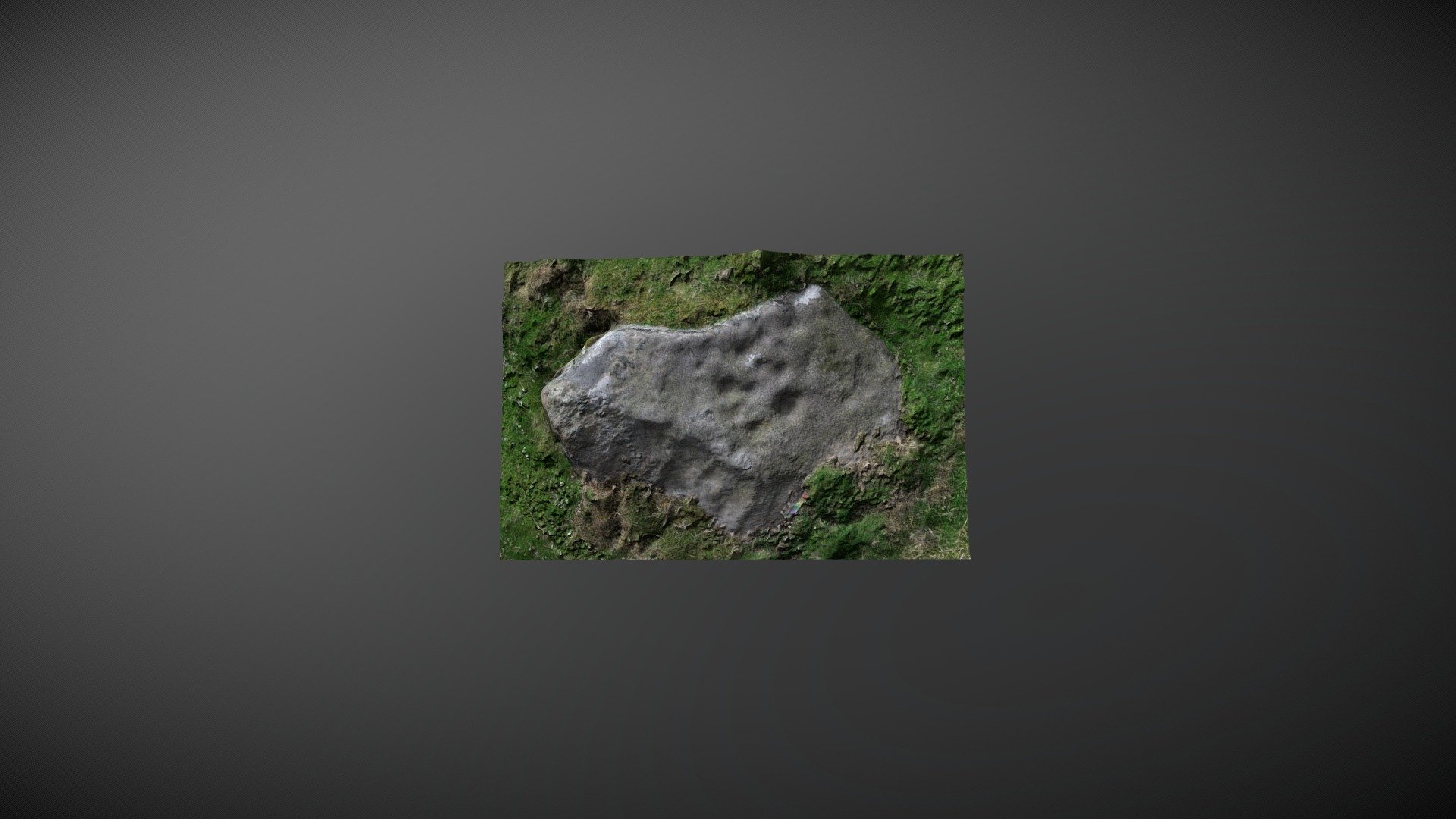
Low-lying stones are often discovered on the lower north-facing slopes of Eel Hill, Barningham Moor, County Durham. This particular stone is referenced as number 34 in Beckensall & Laurie's 1998 publication 'Prehistoric Rock Art of County Durham, Swaledale and Wensleydale'. The Northumberland Archaeological Database Record Access Project added it to the English Heritage database as 'Barningham Moor 55' in 2008. Their team describes this stone: "Ten cups of varying size and depth are clustered in a central position on this stone, with two linked by a short groove. Other boulders are situated nearby." The ERA record can be viewed online at https://archaeologydataservice.ac.uk/era/section/panel/overview.jsf?eraId=854. Historic England has scheduled the area where this stone is located as part of their list, which can be accessed at https://historicengland.org.uk/listing/the-list/list-entry/1017441. The 3D model was created from six stereo pairs captured by the NADRAP Team 5 in June 2006. This imagery forms a part of the full NADRAP archive deposited with Historic England and Northumberland County Council.
With this file you will be able to print Barningham Moor 55 (June 2006) with your 3D printer. Click on the button and save the file on your computer to work, edit or customize your design. You can also find more 3D designs for printers on Barningham Moor 55 (June 2006).