Barningham Moor 45 (Nov 2006)
sketchfab
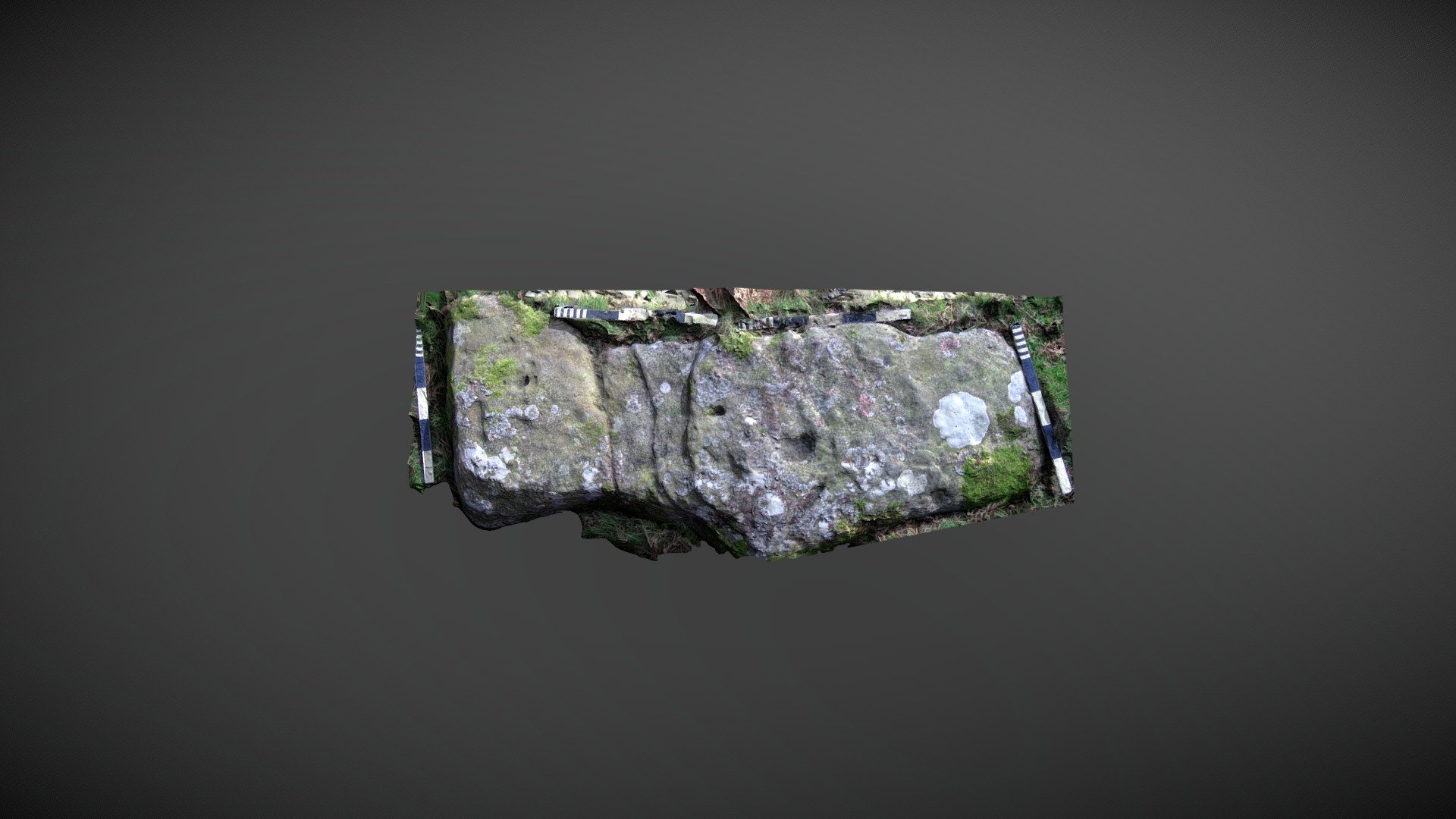
Stone discovered within a dense cluster of other carved rocks, situated north of Eel Hill on Barningham Moor in County Durham. This stone was identified as a possible map reference noted during English Heritage's Monument Protection Programme survey in 1995/6. Added to the ERA by NADRAP in 2008 as 'Barningham Moor 45', the team describes: "The stone appears to have naturally formed cups but also four others that may be eroded artificial markings. Two grooves can be seen running east to west, with the most central following a natural fault across the rock; the northerly groove joins two cups and is more likely to be artificial." ERA record: https://archaeologydataservice.ac.uk/era/section/panel/overview.jsf?eraId=844 Historic England area scheduling: https://historicengland.org.uk/listing/the-list/list-entry/1017439 A model created from 2 stereo pairs captured by NADRAP Team 5 in November 2006 forms the imagery. The imagery is part of the ERA/NADRAP archive.
With this file you will be able to print Barningham Moor 45 (Nov 2006) with your 3D printer. Click on the button and save the file on your computer to work, edit or customize your design. You can also find more 3D designs for printers on Barningham Moor 45 (Nov 2006).