Atka Bay - Antarctic Terrain Model
prusaprinters
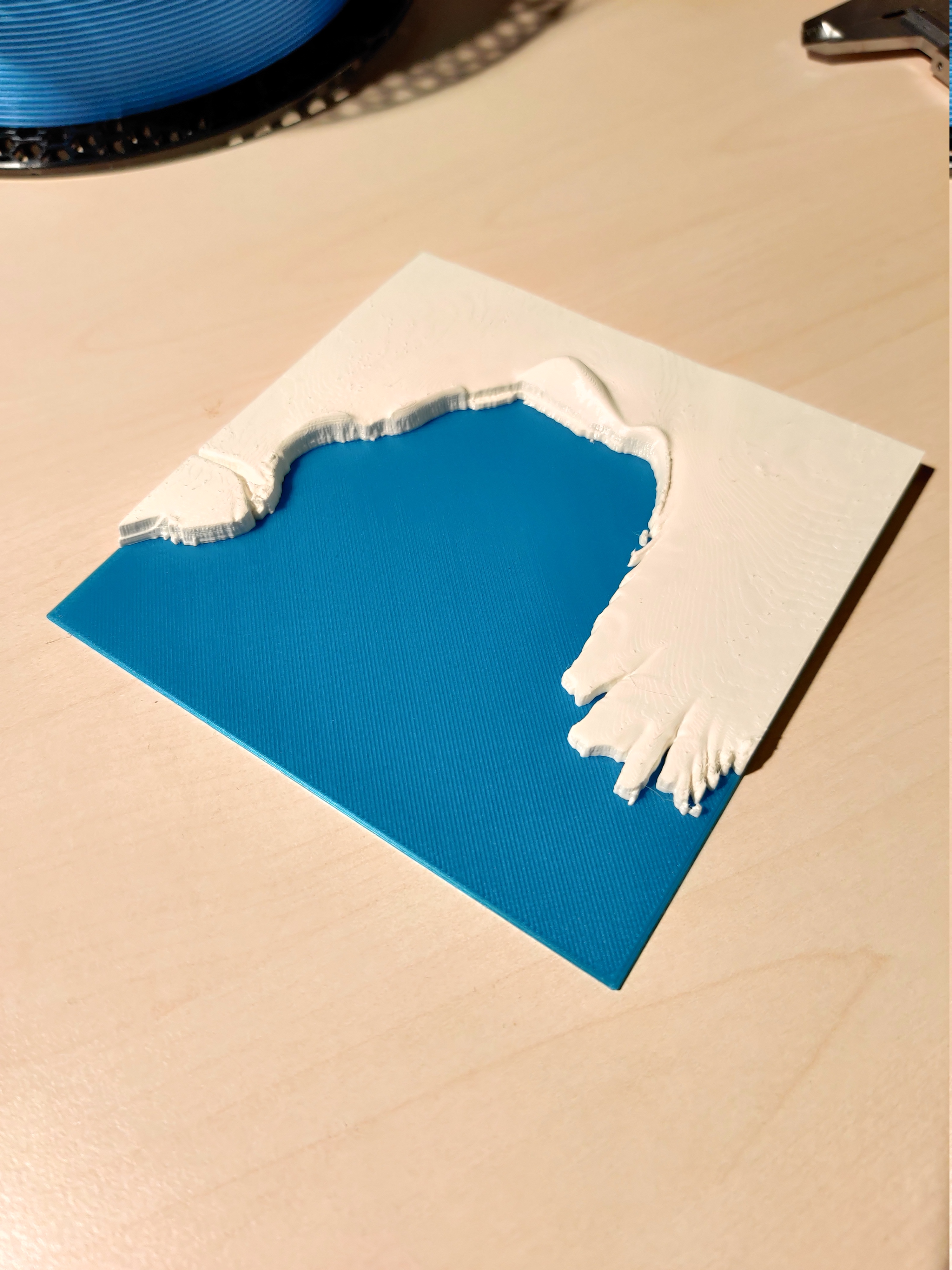
<p>3D Elevation Model of Atka Bay, located near Neumayer Station in Antarctica.</p><p>The model is created from elevation data taken from REMA (Reference Elevation Model of Antarctica), which you can browse interactively here: <a href="https://livingatlas2.arcgis.com/antarcticdemexplorer/">https://livingatlas2.arcgis.com/antarcticdemexplorer/</a> . The source data I used has a resolution of 8 m per pixel. I transformed the elevation mesh to an STL model using a custom Python script. The model is exaggerated in the z-axis to show more topographic details.</p><p>To print the model with a high surface resolution, you can use the variable layer height feature of your slicer. In the provided .3mf and .gcode files, the layer height varies between 0.20 mm and 0.07 mm. Insert a color change after 1.00 mm to distinguish the ocean from the iceshelf.</p><p> </p><p>Data<i>: Howat, I. M., Porter, C., Smith, B. E., Noh, M.-J., and Morin, P.: The Reference Elevation Model of Antarctica, The Cryosphere, 13, 665-674, </i><a href="https://doi.org/10.5194/tc-13-665-2019"><i>https://doi.org/10.5194/tc-13-665-2019</i></a>, 2019.</p>
With this file you will be able to print Atka Bay - Antarctic Terrain Model with your 3D printer. Click on the button and save the file on your computer to work, edit or customize your design. You can also find more 3D designs for printers on Atka Bay - Antarctic Terrain Model.