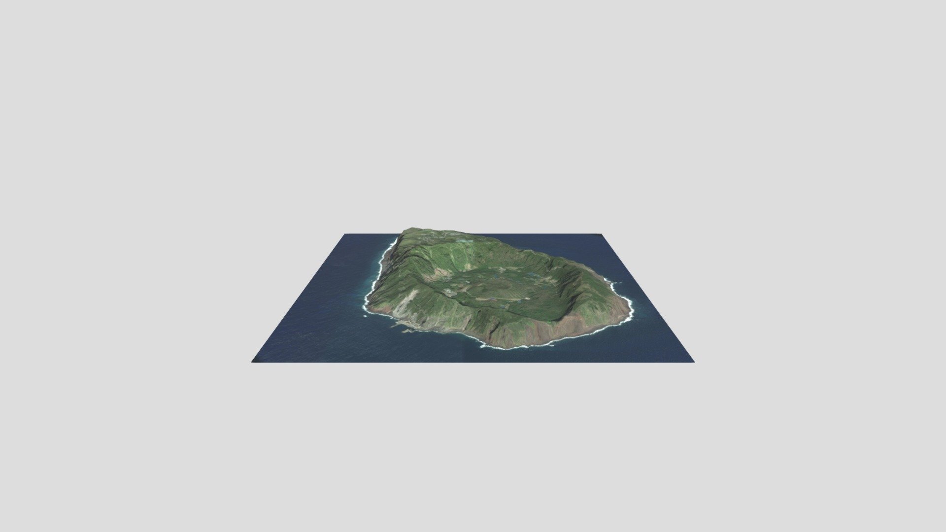
Aogashima, Japan
sketchfab
Generator: DEM Net Elevation API - https://elevationapi.com DEM Net Elevation API (elevationapi.com) offers its services under the MIT license, making it free for companies with less than $100K in gross revenue. Digital Elevation Models are provided by SRTM_GL1 OpenTopography at https://opentopography.org/. For more information on SRTM data, visit http://www2.jpl.nasa.gov/srtm/srtmBibliography.html and https://doi.org/10.5069/G9445JDF. Imagery comes from Esri World Imagery - https://services.arcgisonline.com/ArcGIS/rest/services/World_Imagery/MapServer, a collection of sources including Esri, DigitalGlobe, GeoEye, Earthstar Geographics, CNES/Airbus DS, USDA, USGS, AeroGRID, IGN, and the GIS User Community.
With this file you will be able to print Aogashima, Japan with your 3D printer. Click on the button and save the file on your computer to work, edit or customize your design. You can also find more 3D designs for printers on Aogashima, Japan.