Aerial texture 270 Texture
cgtrader
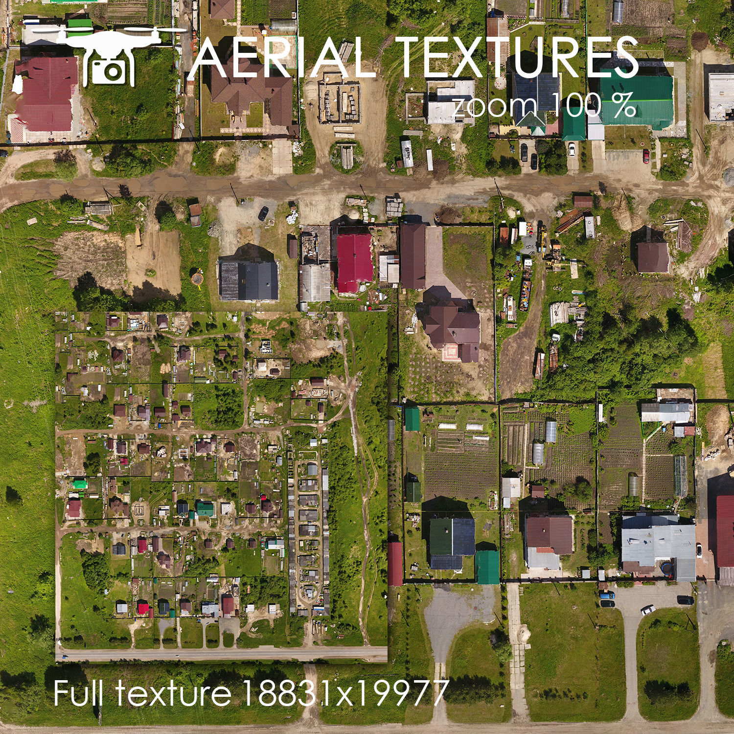
The landscape's texture is mapped from multiple angles, all captured by a quadcopter flying steadily at an altitude of 60 meters. Each high-resolution image comprises hundreds of actual photos merged seamlessly together for exceptional realism. Every feature and detail in the terrain's surface has been meticulously recreated for maximum accuracy. File 1 includes the textured mesh. File 2 is the model optimized specifically for 3ds Max, using Vray rendering engine. File 3 is a FBX format containing detailed geometric data. File 4 consists of material information used to assign visual properties to objects in the scene. File 5 provides essential MTL file with necessary texture coordinates and settings.
With this file you will be able to print Aerial texture 270 Texture with your 3D printer. Click on the button and save the file on your computer to work, edit or customize your design. You can also find more 3D designs for printers on Aerial texture 270 Texture.