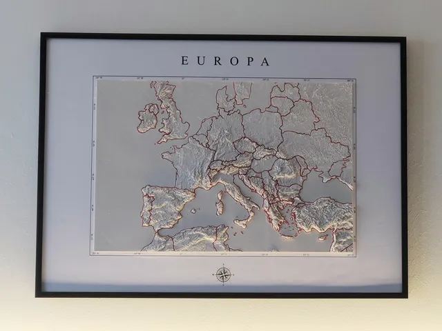
3D Relief Europe Topology Map
prusaprinters
This 3D printable relief map of Europe is a detailed model that depicts the physical features of the continent, including its mountains, valleys, and plains. The map is based on topographical data, providing an representation of the elevation and contours of the land (Small altitudes were pushed to be higher for better 3D effect).The country outlines are engraved into the surface and can easily be traced in color for better visibility.I printed my version in 6 14x14 cm tiles on an Ender 2 Pro. For those of you with giant printers, i also included the full map in one piece :)The biggest problem i had while printing was the warping of the edges. This probably can be solved with the right printer settings or by using a brim. If i printed this model again, i would make sure the edges don't warp so the tiles fit together perfectly and don't need to be sanded, filled and painted.For those that want to recreate my exact version, i included the backdrop (English: Europe and NESW compass directions, German: Europa with NOSW compass directions.) I had to remove the compass at the bottom because of copyright. The map and backdrop fit a Din A2 (420x594mm) size frame if the tiles are printed in 14x14 cm.This is how I created my framed version:print all 6 tiles in 14x14 cmglue them together on a thin flat piece of woodsand, fill in the gaps and paint (spray paint)trace country outlines with a thin brushparts ordered: Din A2 frame, Din A2 foam board (5mm thick)print backdrop in A2 (I used a printing service for CAD drawings)glue backdrop onto foam boardcut a hole for the map and put it in. If you are lucky, it stays in without glueI look forward to seeing your prints and remixes of this map.
With this file you will be able to print 3D Relief Europe Topology Map with your 3D printer. Click on the button and save the file on your computer to work, edit or customize your design. You can also find more 3D designs for printers on 3D Relief Europe Topology Map.
