3D Print a Hill Models
thingiverse
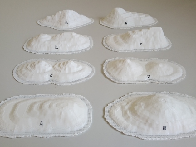
These landscape models should help students better understand topographic maps. Exercises for using these models in geography or science lessons are available here* or in Kristjan Rea's master's thesis “Applying virtual 3D-models and physical 3D-models created by a 3D-printer for learning about the topic “Landforms and Groups of Landforms” in basic schools”. Link for the master's thesis: https://goo.gl/3Aq2gR NB! It is recommended that students themselves participate in the process of making these models. These landscape models should help students better understand topographic maps. Exercises for using these models in geography or science lessons are available here* or in Kristjan Rea's master's thesis “Applying virtual 3D-models and physical 3D-models created by a 3D-printer for learning about the topic “Landforms and Groups of Landforms” in basic schools”. Link for the master's thesis: https://goo.gl/3Aq2gR NB! Students should ideally participate in making these models. I Designed This Step1 In Adobe Illustrator CS6, I created a top view of the landscape model (including contour lines). Step 2 The Illustrator file was modeled in Blender 2.76 and then converted into an STL file. Step 3 After printing the model, I drew paths (green), a river (blue), and exercise points (black) with a marker. *How to use these models in classroom Exercise for the landscape models Inspect contour maps (available in Kristjan Rea's master's thesis) and match them with correct landscape models. Write the correct letter inside the box below the contour map.
With this file you will be able to print 3D Print a Hill Models with your 3D printer. Click on the button and save the file on your computer to work, edit or customize your design. You can also find more 3D designs for printers on 3D Print a Hill Models.
