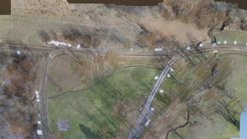
1.5 acre residence
sketchfab
I am conducting a thorough aerial survey of this 1.5-acre property in West Virginia's hilly terrain. To capture precise data, I utilized a 3D Robotics Iris + drone equipped with a Canon S100 camera loaded with CHDK scripting. The collected images were then processed using Agisoft Photoscan Standard software to create detailed 3D models, which were exported as .obj and .mtl files. My flight plan involved flying at an altitude of 60 meters above the ground. However, I faced significant challenges in achieving sufficient overlap between photographs due to the dense tree cover in the area. The resulting model reveals these obstacles in the form of spikes, clearly indicating the presence of trees on the property.
With this file you will be able to print 1.5 acre residence with your 3D printer. Click on the button and save the file on your computer to work, edit or customize your design. You can also find more 3D designs for printers on 1.5 acre residence.
